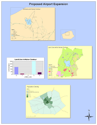
Above: Exercises 1-5 on ArcGIS Tutorial
Had it not been for the very detailed step by step instructions on on the tutorial for the ArcGIS Software, I am certain I would have been lost. I have always considered myself to be a computer savvy person, but after this tutorial I realize I still have MUCH to learn. Organization is probably the most important element in this process, as a lack of organization can have its consequences. I ran into one little set back strictly because I was not as organized as I should have been with my folders from the very beginning. This being something completely new for me, I realize the only way to really become comfortable with the software is through a process of trial and error. Making mistakes, and leaning how to fix them has always been the best way for me to learn. I have so far only gone though the tutorial one time, and I plan on spending a lot more time the next few times I go through it and playing around with the different features a but more.
It took me a couple of hours just to figure out how to use the remote access and work on the UCLA network from home. Just the fact that I was able to remotely access the computers in the UCLA labs from so far away amazed me. The fact that you can only access the computers after hours really put some time constraints on me, which was somewhat frustrating because I couldn't get things done when I had time to do them during the day. I guess the luxury of having such an advanced technology at your fingertips has to have certain drawbacks, and for me this was one.
Prior to this tutorial, I knew absolutely nothing about ArcGIS and did not realize how very helpful in solving real-life problems programs like this one are. It was really interesting to see the process first hand, and to have a hands on introduction to the software. It was very quick and easy when being guided through the steps, especially because the information we were working with was so easily at our disposal. There will not be many instances, I am sure, where the data to take on a project such as noise levels in airport expansion will be so readily available. The real test will come when I have to start from scratch.
Overall, it was exciting to have this introduction into using the Arc GIS software. Obviously I feel more comfortable using the software after the tutorial than before because I had no prior knowledge about it. It is without a doubt complex, and I will need to continue referring back to what I learned in these 5 exercises for future reference.
No comments:
Post a Comment